
This year is the 200th anniversary of the Ratcliffe Highway murders, when seven people were killed in a gratuitous frenzy in the space of 12 days. But while 19th century Londoners would have recoiled at the mention of John Williams and his crimes, they probably mean little to the city’s present day inhabitants.
Likewise the scenes of the murders are vastly different to how they were in December 1811. At that time, Ratcliffe Highway ran east from Tower Hill through Wapping and Shadwell to Limehouse. To the south were the docks where ships brought in tobacco, tea and sugar (and sailors), while to the north was the church of St George’s-in-the-east, Cable street and Whitechapel.
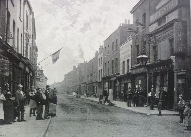
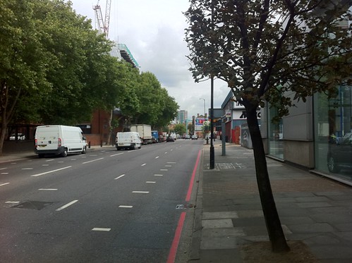
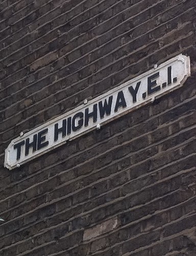
In those days the highway was lined either side with shops, pubs, tenements and narrow, dark alleyways. The expansion of the docks and the blitz did their part to reshape the road and now it is known simply as ‘The Highway’. The cramped dwellings have been replaced with trees, small industrial units, grassland, a building site, and a warehouse dating from 1882, now converted into flats. To the south lies the fortress of News International, former home of the now-defunct News of the World.
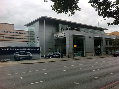
The scene of the first murder was the home and business of linen draper Timothy Marr at number 29 on the south side. The numbering of the street has changed with the name but the road roughly opposite the location, Betts Street, remains. At the time of the publication of P.D. James’ book about the murders, Marr’s house had been replaced by a block of flats. It seems the site of Marr’s shop is now a Saab dealership.
The second murder scene, at which a husband and wife and their maid were battered to death 12 nights later, was at the King’s Arms pub at 81 New Gravel Lane. This road, which is further east down the Highway, is now called Garnet Street.
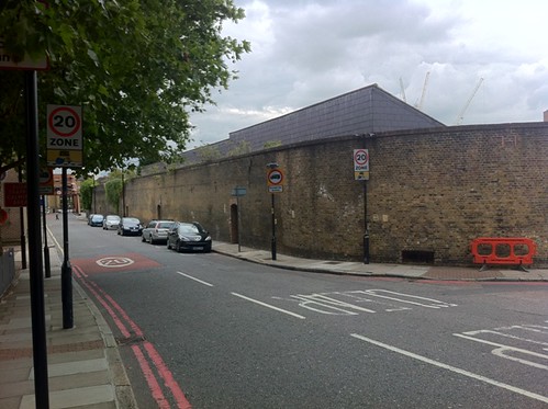
The King’s Arms would have been somewhere on the west side of Garnet street (pictured above, heading south). It was knocked down in the 1830s for the extension of London Dock. The dock wall remains today, but behind it you now find blocks of post-war flats.
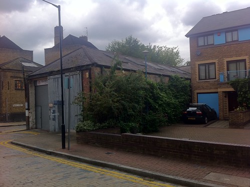
Heading down Garnet Street takes you towards Wapping and the site of the Pear Tree lodging house which became the centre of the police investigation. It was there where a bloodied knife was found hidden in a closet. The carpenter’s maul used by the killer had also been previously kept there in a locker.
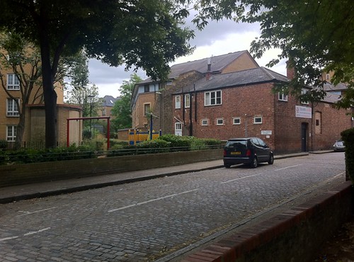
Pear Tree Alley, which was said to run off Cinammon Street, no longer exists but seems to have run parallel to what is now called Clegg Street. In the 1960s it was still a derelict bomb site but it is now the site of a small block of flats and a children’s playground.
There is however a ‘Pear Tree Lane’ which it is claimed was named after the pub, located to the east of St Paul’s Shadwell and the west of Glamis Road and the Shadwell Basin.
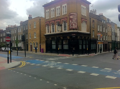
The final location to visit is the burial site of John Williams, who committed suicide before facing trial. He was dumped in a hole at the crossroads of Cannon Street Road and Back Lane (now Cable Street). His body was dug up again 100 years later by workmen installing new mains. According to legend the skull was kept by the owner of the Crown and Dolphin pub at the corner.
I just started a YouTube channel on crime and londons dark history and this will be my very first long form video. My channel is TONE TALKS HISTORY give it a check id appreciate the sub and leave a comment telling me you’re from here id love to chat with you a bit more in depth
Thanks for the reply.
Yes, he was a business man but only for a matter of months. He surely cdnt have amassed that sum in so short a time. He was a 24-year-old modestly paid former sailor. I cannot get away from the notion that this sum of money may have some bearing on the case…tho’ what, I haven’t a clue.
There’s a hint it’s something to do with the East India Company, which according to most accounts employed Marr as well as the two prime suspects in the case. Maybe it’s worth digging in the digital archives to see if there’s anything that hasn’t already been covered in James/Critchley’s book on the case.
I guess one theory would be the killer knew about the money, was disturbed while looking for it and then killed the whole family in an attempt to conceal his crime – though whether that would explain the excessive violence used in both sets of murders is another thing.
I’m puzzled. How did Timothy Marr manage to have saved the £152 found in a drawer in the bedroom. He’s very young; he is having to spend money on the premises they’re living in; I don’t imagine that in his short life he’s ever earned very much. Any info would be gratefully received.
Interesting point. The £152 (or 152l as it was written then) appears to come from an article in the Sussex Advertiser (though it may have been repeated in or taken from other papers) and according to some conversion websites £152 in 1811 is worth £12,500 today (based on inflation though it’s not really directly comparable). Timothy Marr was described as a silk-mercer though he also dealt in furs and lace – so maybe it was a particularly lucrative business…
I have just found out that my 4th great grandfather and mother were victims of this event. They were the landlord and landlady of the Kings Arms. Their names were John and Elizabeth Williamson.
Interesting discovery! – are you related to the granddaughter who survived the attack (Kitty Stilwell?).
They’re mine too.